






 Back to Search
Notice of Committee Hearing
The Public is invited to participate in a Committee of Adjustment Hearing on Thursday, June 25, 2026 at 2:00 p.m.
How to Participate
Submit written comments, by emailing coa@thunderbay.ca no later than Wednesday, June 24, 2026. Please quote the file number in your submission.
Participate online using Microsoft Teams. Online participants must register by the end of the day on Wednesday, June 24, 2026. Please email coa@thunderbay.ca to register.
Attend in person, by visiting Council Chambers on the 3rd Floor of City Hall (500 Donald Street East)
Watch live from home by visiting www.thunderbay.ca/watchcouncil
Additional Information
If you wish to be notified of the decision of the Committee of Adjustment in respect to an application, you must submit a written request to coa@thunderbay.ca.
Copies of all comments will be forwarded to the Committee and to the Applicant. The collection of personal information including names and contact information provided in written submissions is made under the authority of the Planning Act for the purpose of creating a Public Record. Personal information is collected in compliance with the Municipal Freedom of Information and Protection of Privacy Act.
Right to Appeal
Only the applicant, the Minister or a specified person or public body that has an interest in the matter may, within 20 days of the making of the decision, appeal to the Ontario Land Tribunal against the decision of the Committee of Adjustment.
Questions?
If you have any questions about this notice or you require accessible accommodations or materials, please contact:
Zachary Mezzatesta
Acting Secretary Treasurer
(807) 625-2542
Minor Variance & Permission Applications
| A-40-2026: 65 Banning Street |
|
The purpose of the application is to gain relief from the Zoning By-law, as set forth in the application for the retained lot proposed in Consent to Sever Application B-35-2026, and described in the list below:
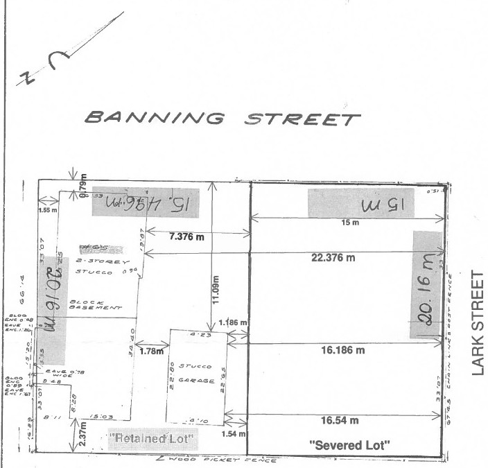
If approved, the effect of this application would be to allow the existing detached house and accessory building to remain on the retained lot, formalizing a shift in frontage from Lark Street to Banning Street. The newly created severed lot will also front onto Banning Street, as described in Application B-35-2025, and no further development is proposed at this time.
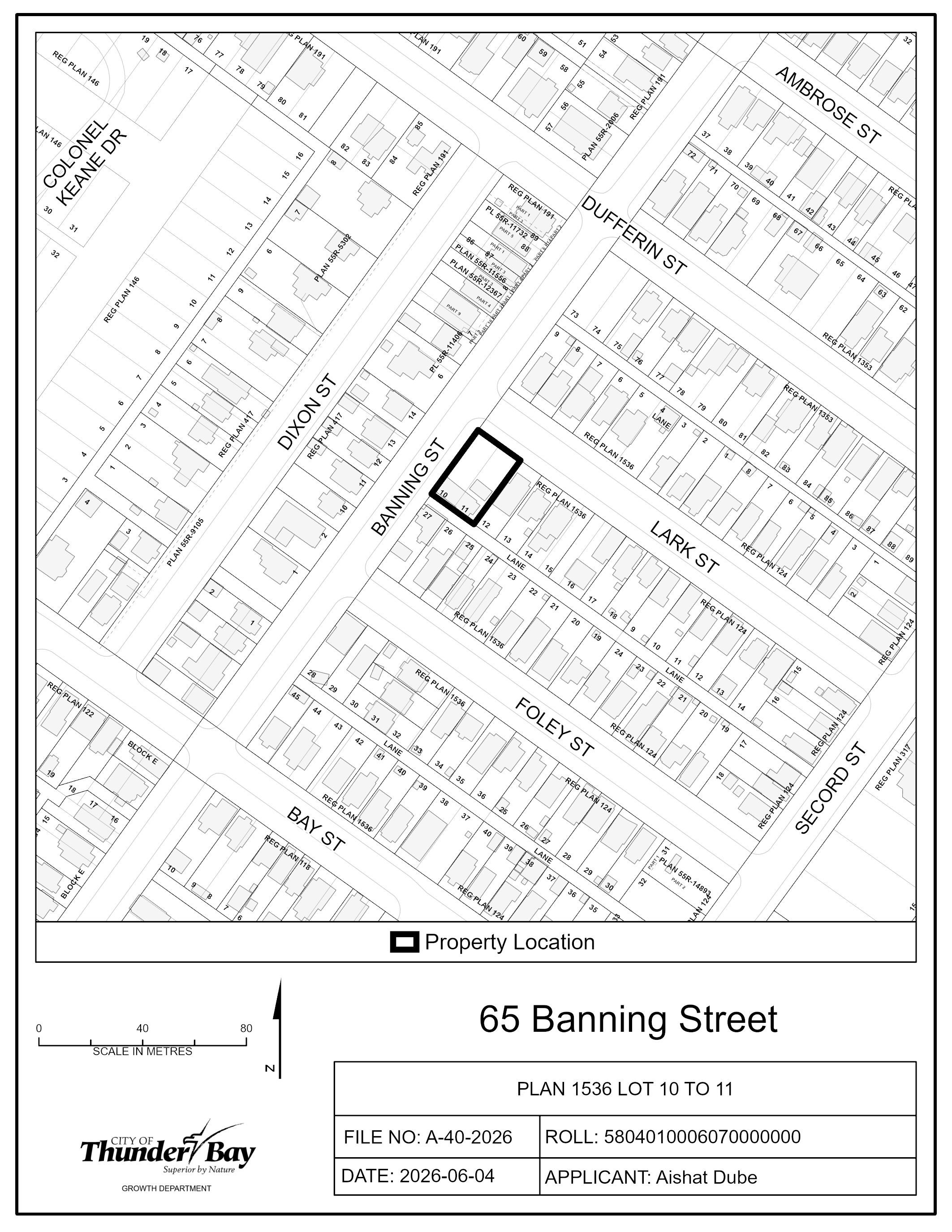
The lands are zoned “UL” – Urban Low-rise Zone and designated as “Residential” in the Official Plan. The applicant’s site sketch and a key map of the subject lands are shown below.
Key Map of Subject Lands
Applicant's Site Sketch
These lands are also the subject of Consent to Sever Application B-35-2026, which is being reviewed concurrently by the City. |
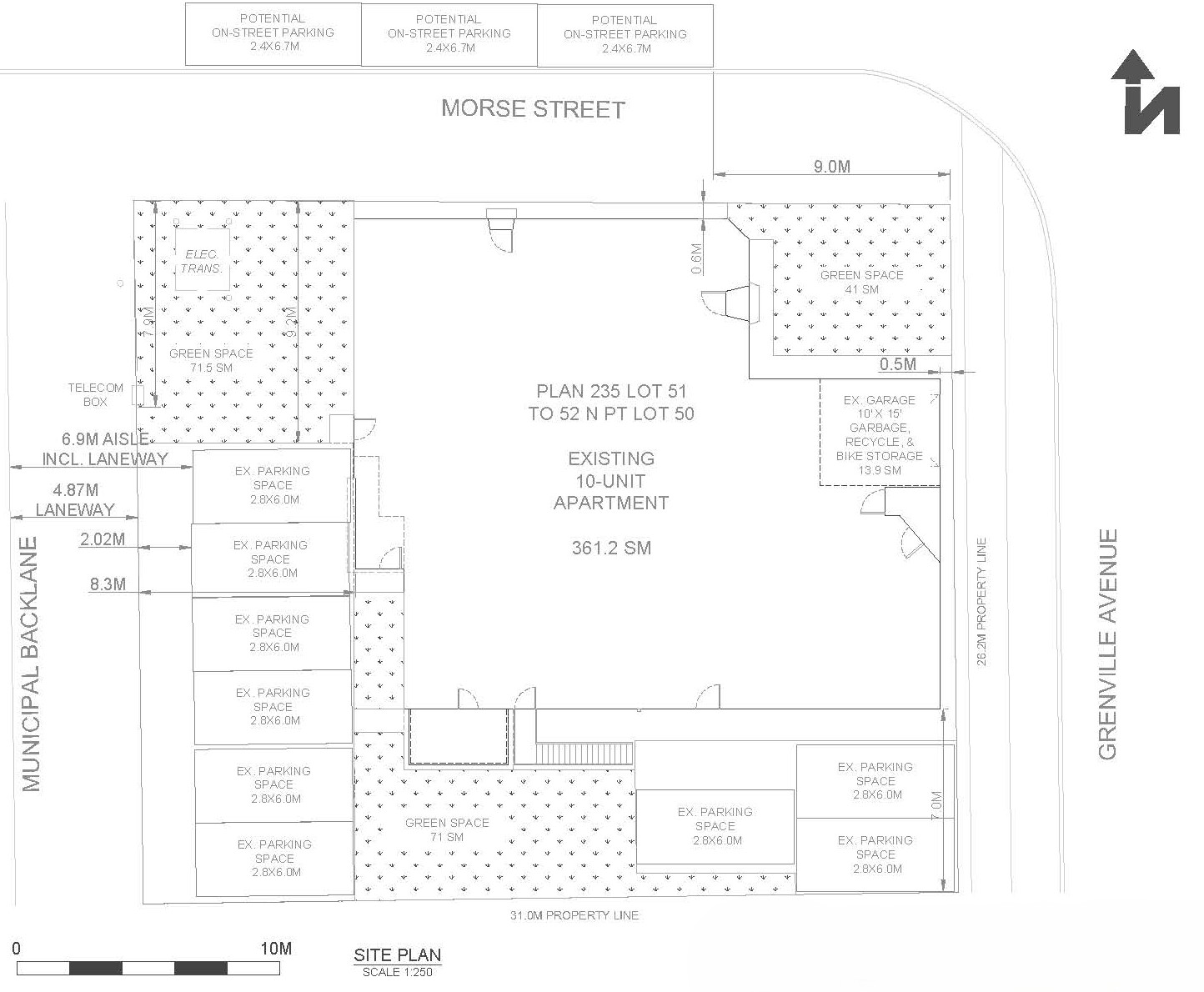
| A-50-2026: 337 Grenville Avenue |
| The purpose of the application is to gain relief from the Zoning By-law, as set forth in the application
and described in the list below:
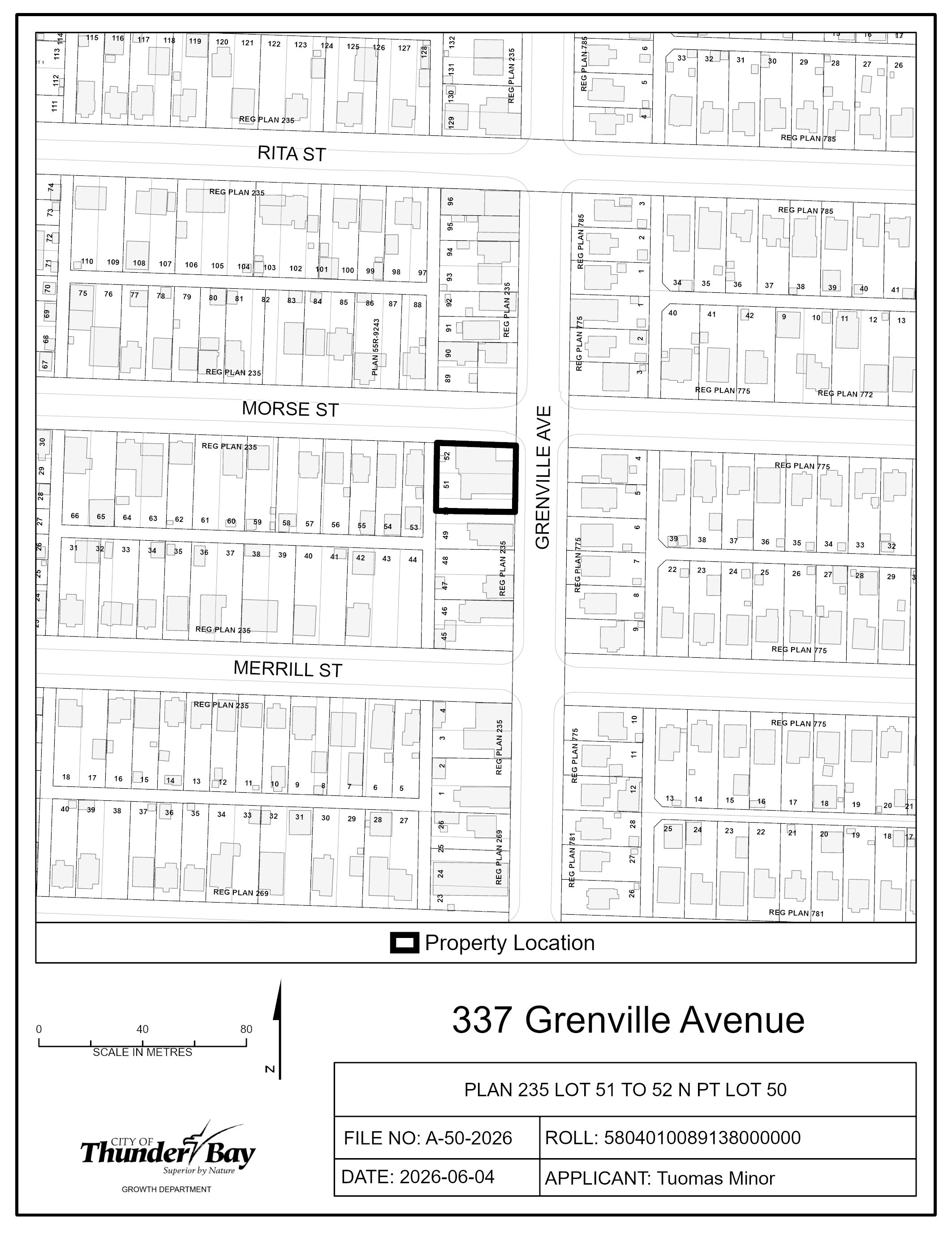
If approved, the effect of this application would be for the continued use of the existing building as a 10-unit apartment. The lands are zoned “UL” – Urban Low-rise Zone and designated as “Residential” in the Official Plan.
The applicant’s site sketch and a key map of the subject lands are shown below.
Key Map of Subject Lands
Applicant's Site Sketch
|
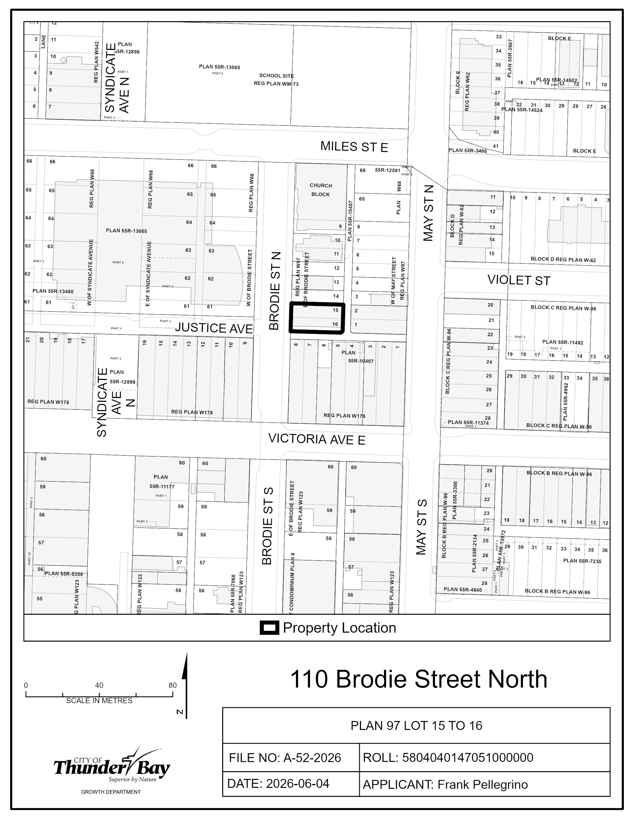
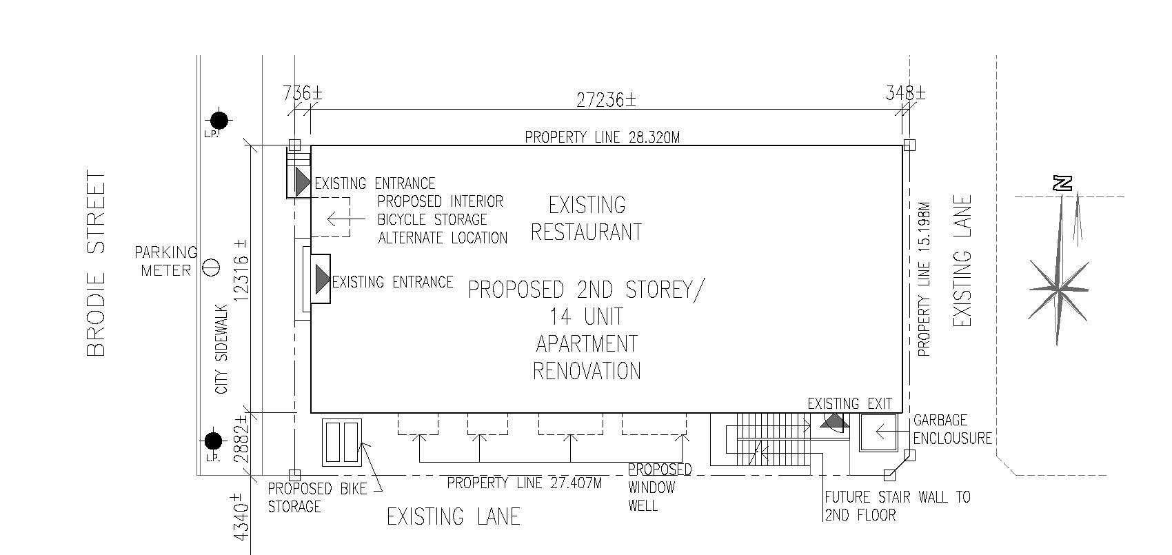
| A-52-2026: 110 Brodie Street North |
The purpose of the application is to gain relief from the Zoning By-law, as set forth in the application and described in the list below:
If approved, the effect of this application would be a reduction of the number of parking spaces required to accommodate a proposed 14-unit apartment. The lands are zoned “DN” – Downtown Neighbourhood Zone and designated as “Strategic Core” inthe Official Plan.
The applicant’s site sketch and a key map of the subject lands are shown on pages below.
Key Map of Subject Lands
Applicant's Site Sketch
|
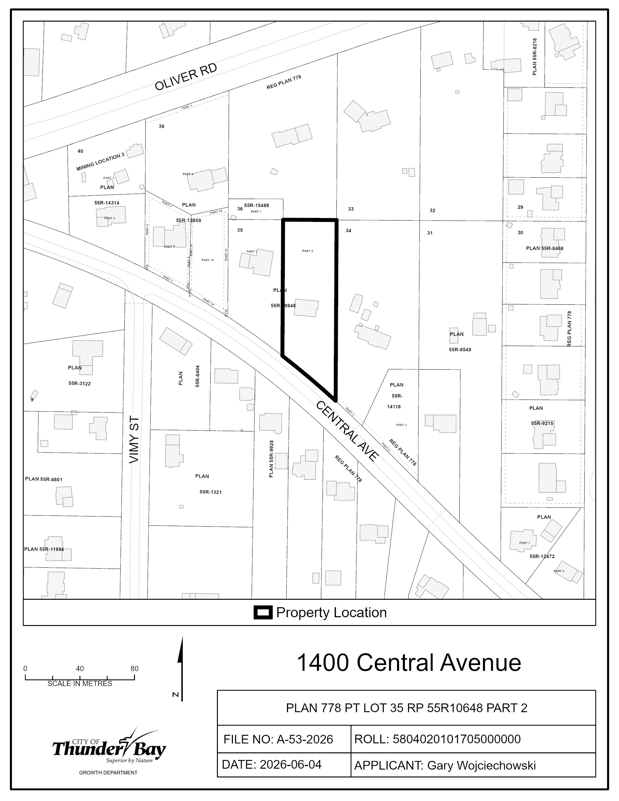
| A-53-2026: 1400 Central Avenue |
|
The purpose of the application is to gain relief from the Zoning By-law, as set forth in the application and described in the list below:
If approved, the effect of this application would be the construction of an accessory building. The lands are zoned “UG” – Urban Growth Zone and designated as “Residential – Growth Area” in the Official Plan.
The applicant’s site sketch and a key map of the subject lands are shown on pages below.
Key Map of Subject Lands
Applicant's Site Sketch
|
| A-54-2026: 361 Hodder Avenue |
|
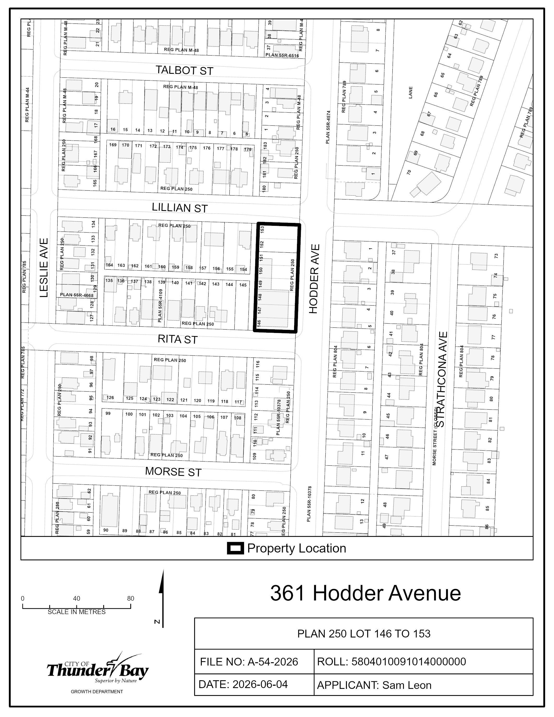
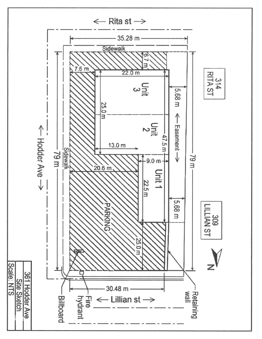
The purpose of the application is to seek permission under Section 45(2)a)ii) of the Planning Act, to change the existing legal non-conforming use. Specifically, the applicant is proposing to change the current Service Commercial use (nail salon) to Office use. No physical changes are proposed as part of this application. The exterior building, site layout, and number of parking spaces will remain the same.
If approved, the effect of this application would be to allow the space currently used as a nail salon (identified as Unit 2) to be converted to an Office use. The lands are zoned “UM” – Urban Mid-rise Zone and designated as “Residential” in the Official Plan.
The applicant’s site sketch and a key map of the subject lands are shown below.
Key Map of Subject Lands
Applicant's Site Sketch
|
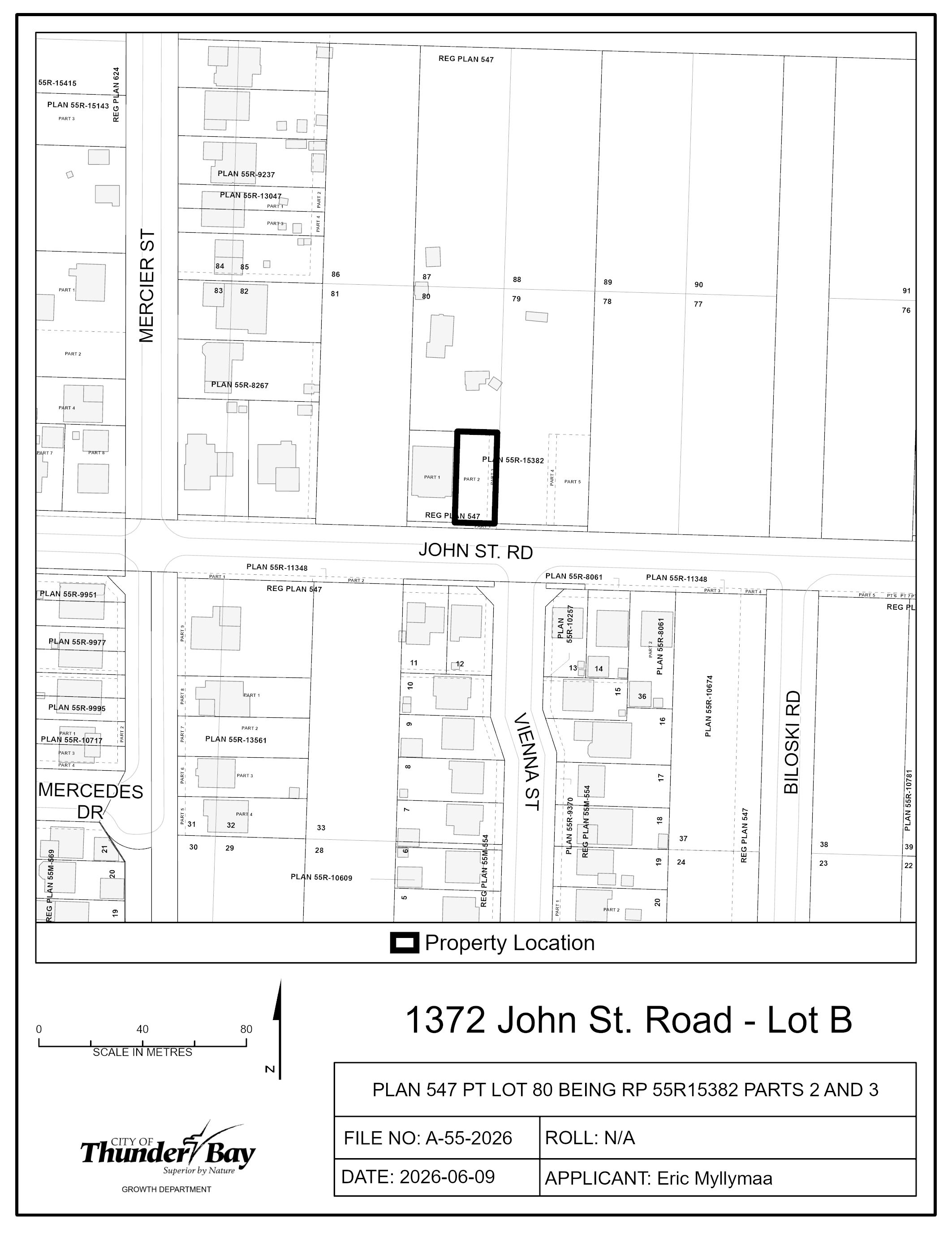
| A-55-2026: 1372 John Street Road "Lot B" |
|
The purpose of the application is to gain relief from the Zoning By-law, as set forth in the application and described in the list below:
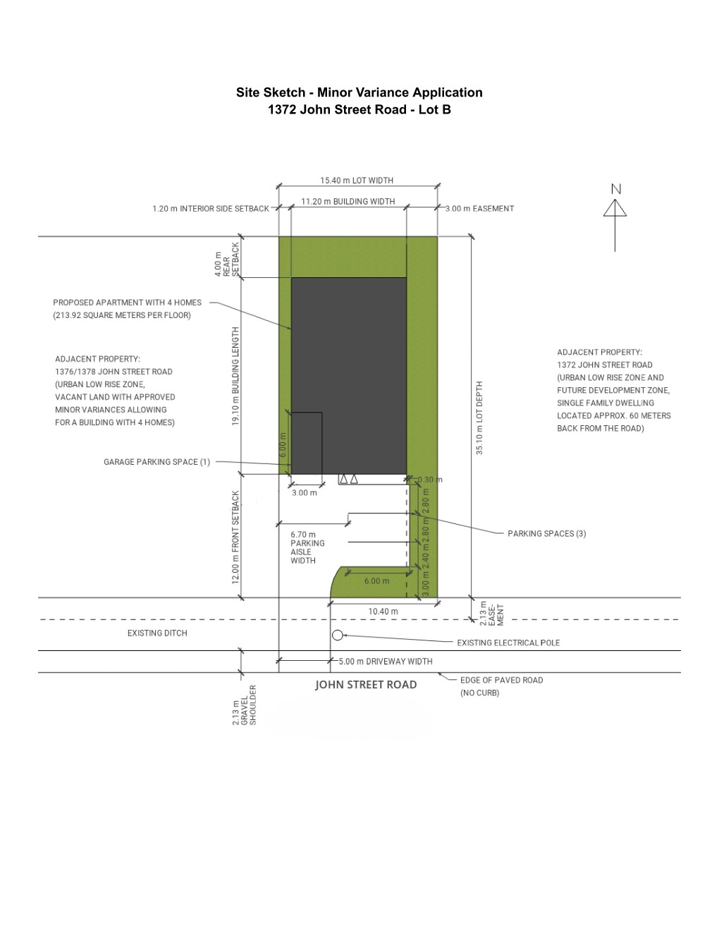
If approved, the effect of this application would be the construction of a four-unit apartment on the
The applicant’s site sketch and a key map of the subject lands are shown below.
Key Map of Subject Lands
Applicant's Site Sketch
|
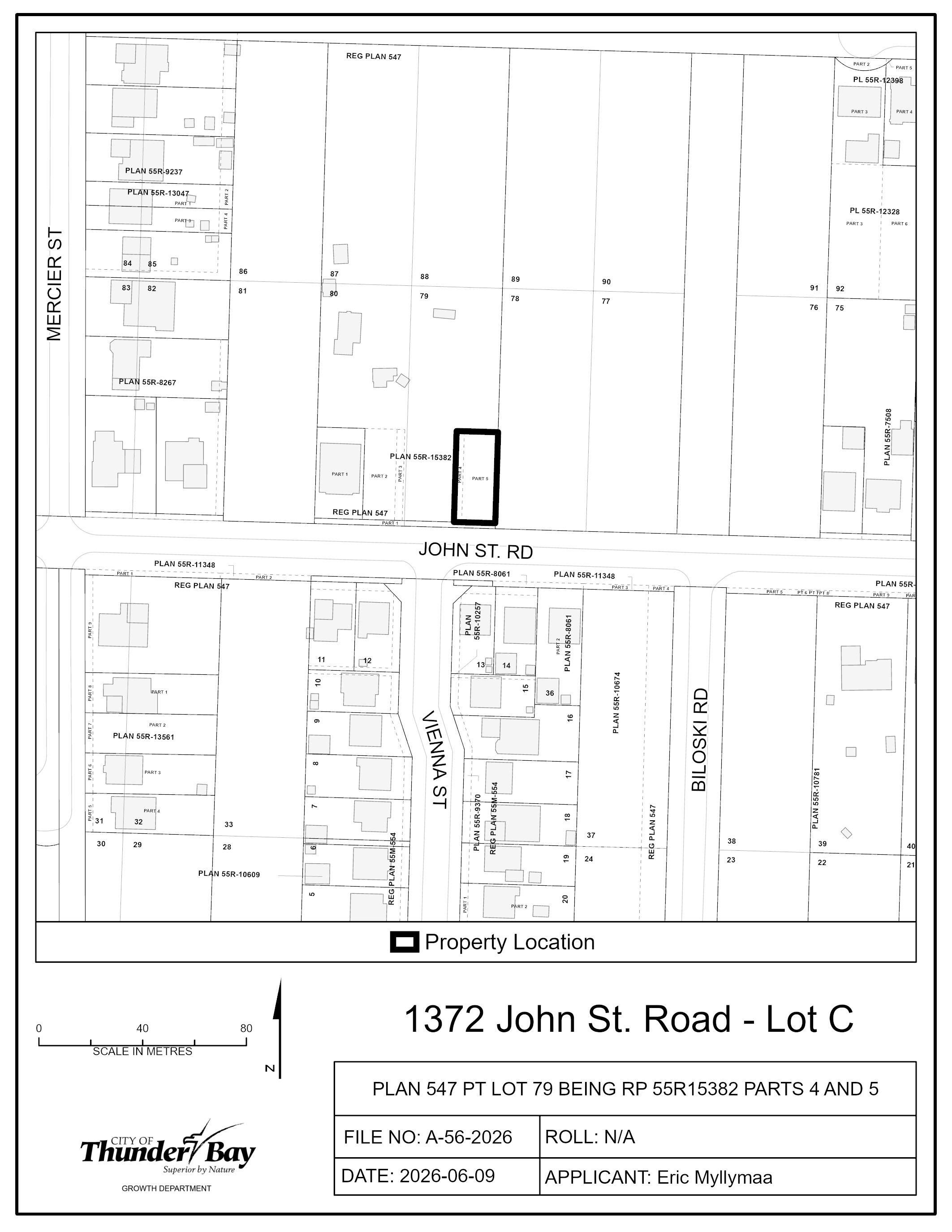
| A-56-2026: 1372 John Street Road "Lot C" |
The purpose of the application is to gain relief from the Zoning By-law, as set forth in the application and described in the list below:
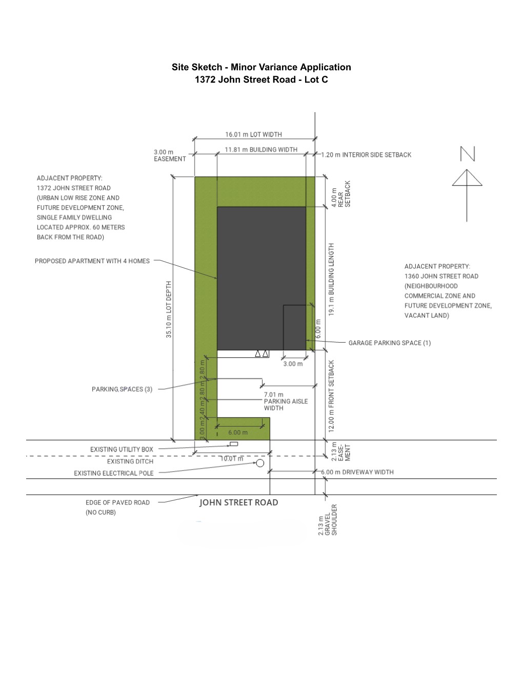
If approved, the effect of this application would be the construction of a four-unit apartment on the
The applicant’s site sketch and a key map of the subject lands are shown below.
Key Map of Subject Lands
Applicant's Site Sketch
|
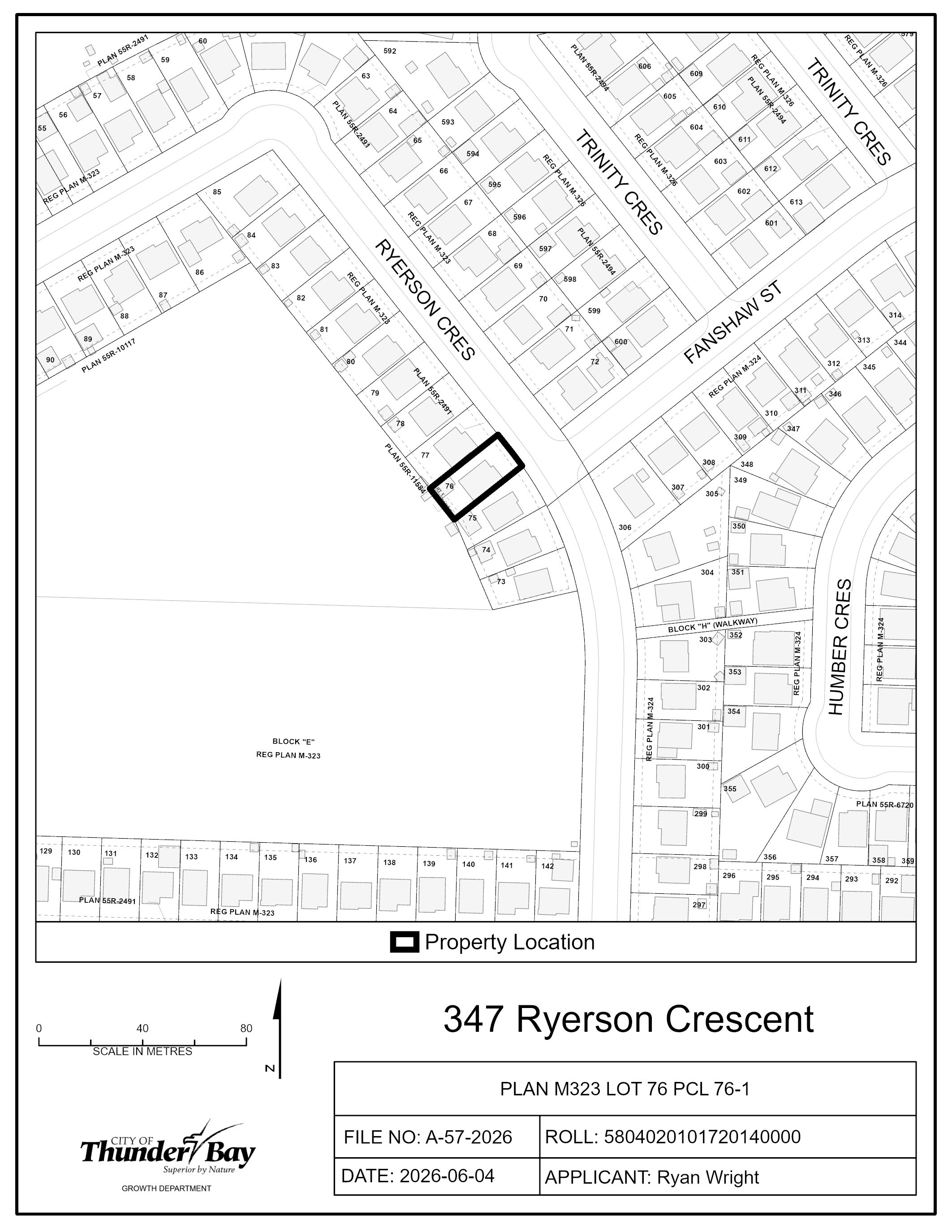
| A-57-2026: 347 Ryerson Crescent |
|
The purpose of the application is to gain relief from the Zoning By-law, as set forth in the application and described in the list below:
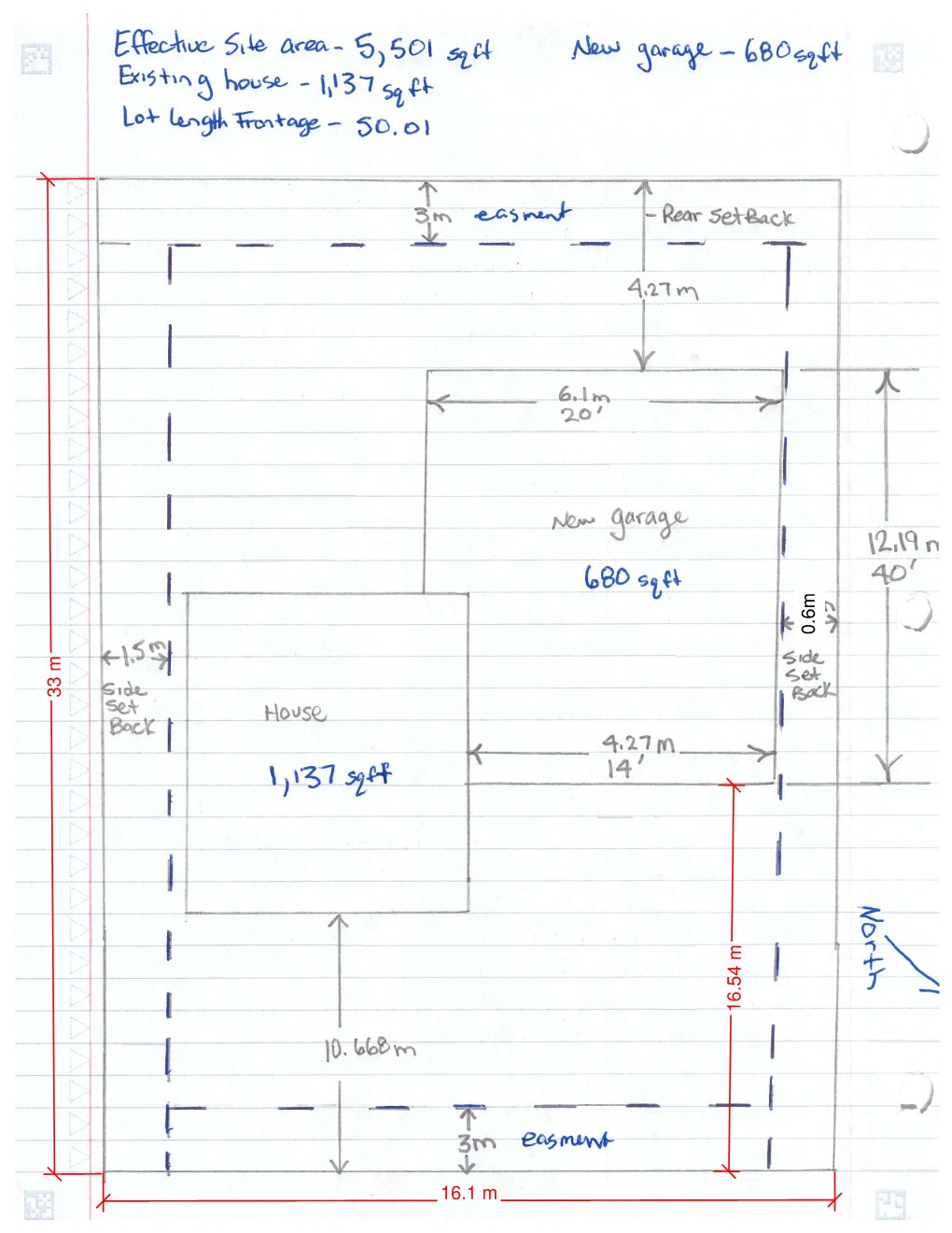
If approved, the effect of this application would be the addition of an attached garage to the existing house. The lands are zoned “UL” – Urban Low-rise Zone and designated as “Residential” in the Official Plan.
The applicant’s site sketch and a key map of the subject lands are shown below.
Key Map of Subject Lands
Applicant's Site Sketch
|
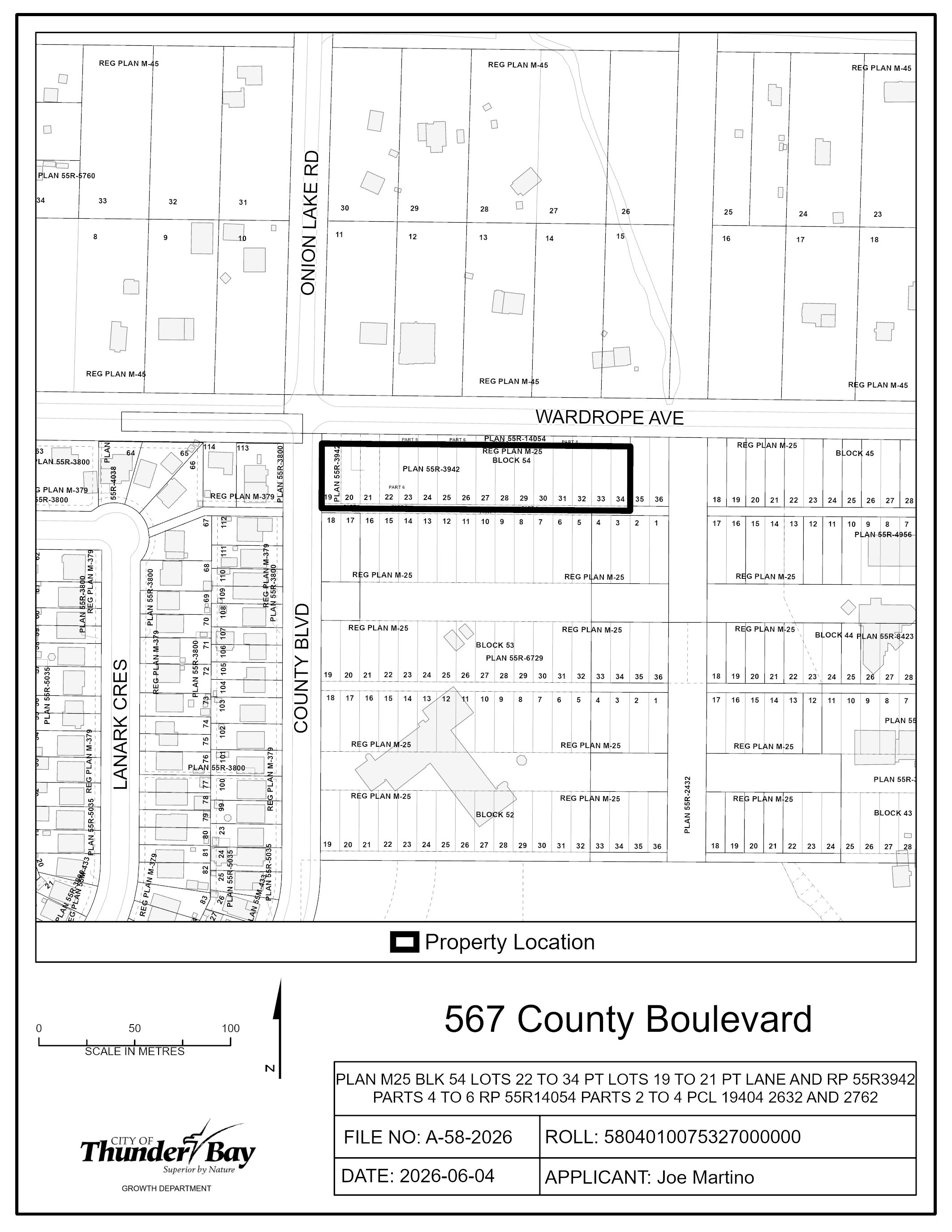
| A-58-2026: 567 County Boulevard |
|
The purpose of the application is to gain relief from the Zoning By-law, as set forth in the application and described in the list below:
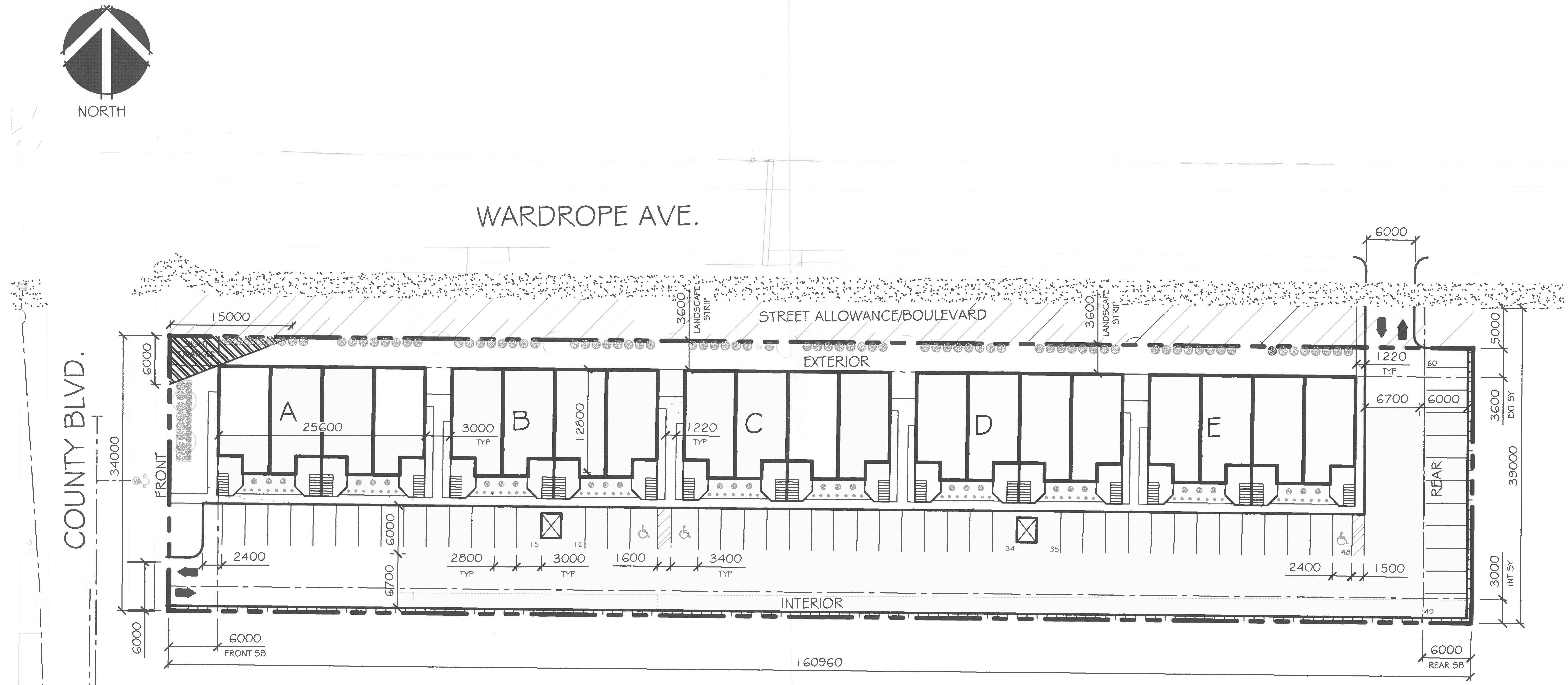
If approved, the effect of this application would be the construction of five 10-unit apartment buildings on the subject lands. The lands are zoned “UM” – Urban Mid-rise Zone and designated as “Residential”, and “Natural Heritage System” in the Official Plan.
The applicant’s site sketch and a key map of the subject lands are shown below.
Key Map of Subject Lands
Applicant's Site Sketch
The subject lands are currently subject to an application for Site Plan Approval, file SPC-03-2026. |
| A-59-2026: 184 Summit Avenue |
|
The purpose of the application is to gain relief from the Zoning By-law, as set forth in the application and described in the list below:
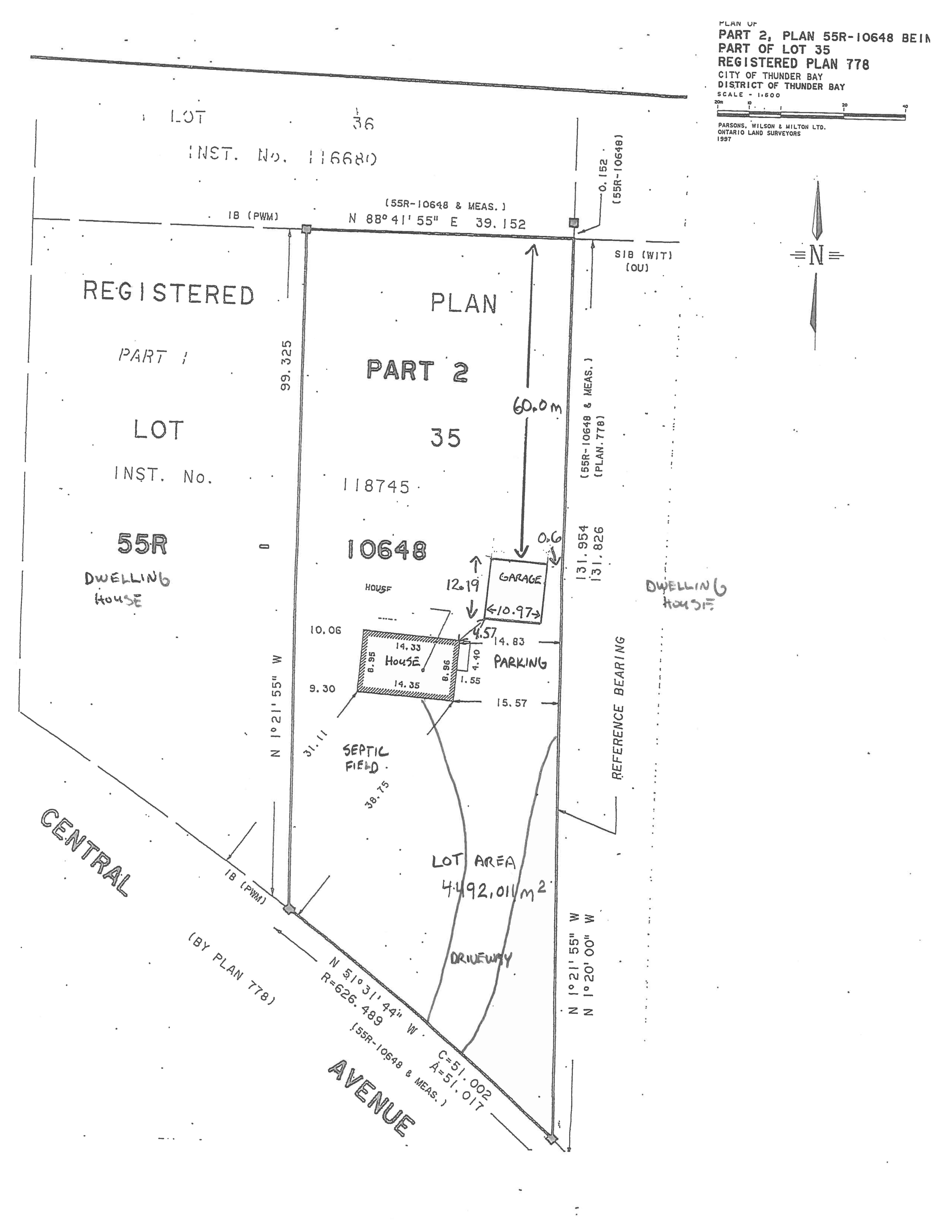
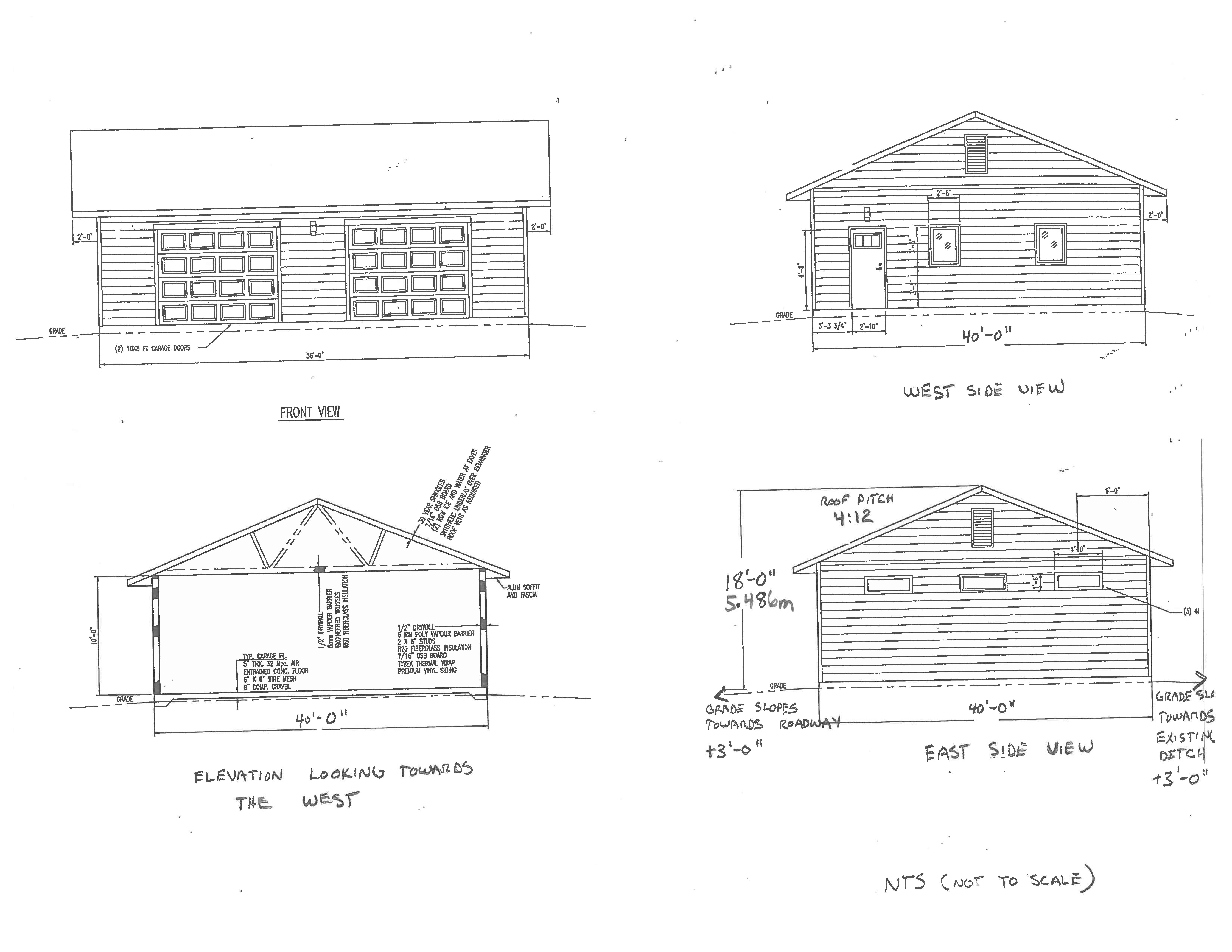
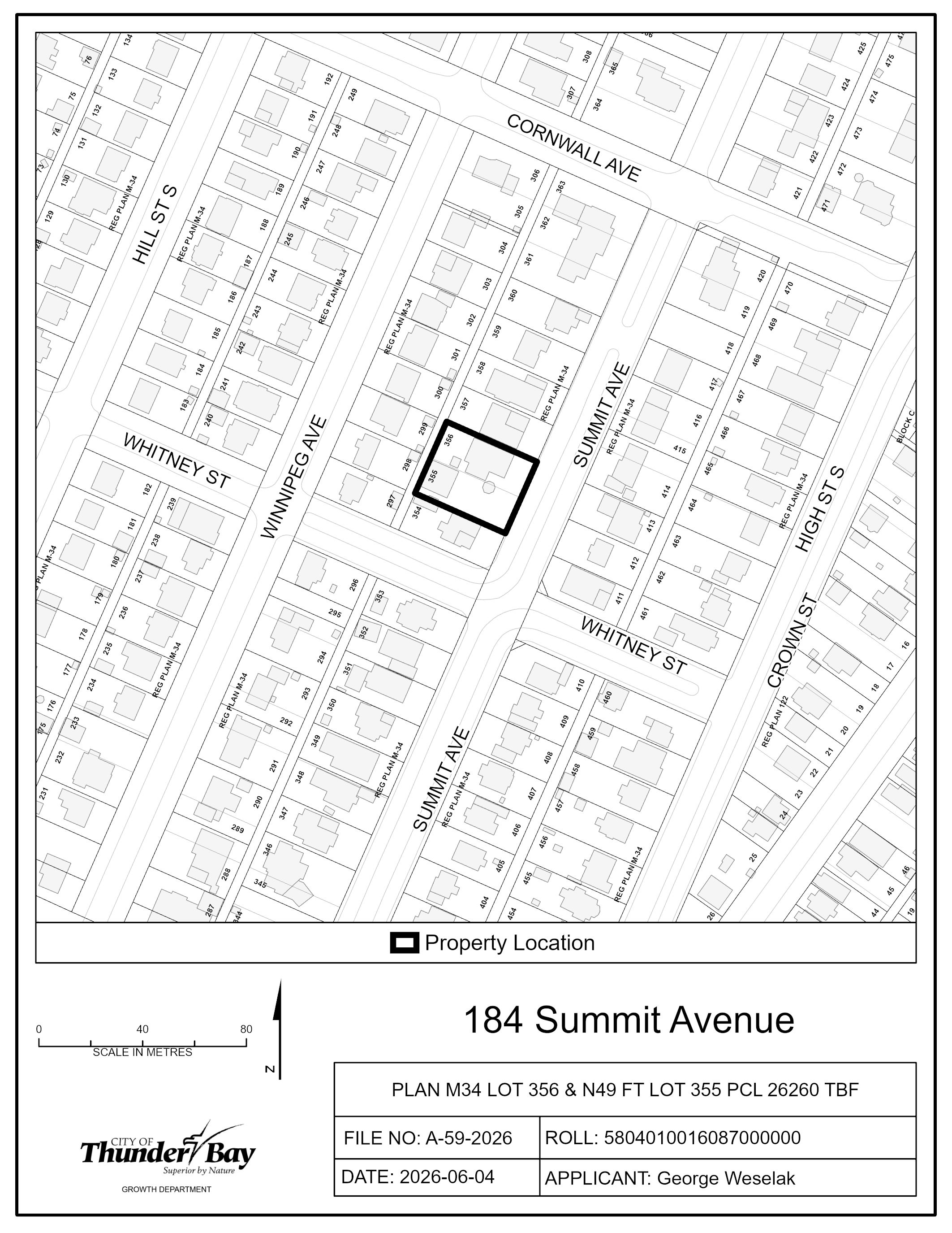
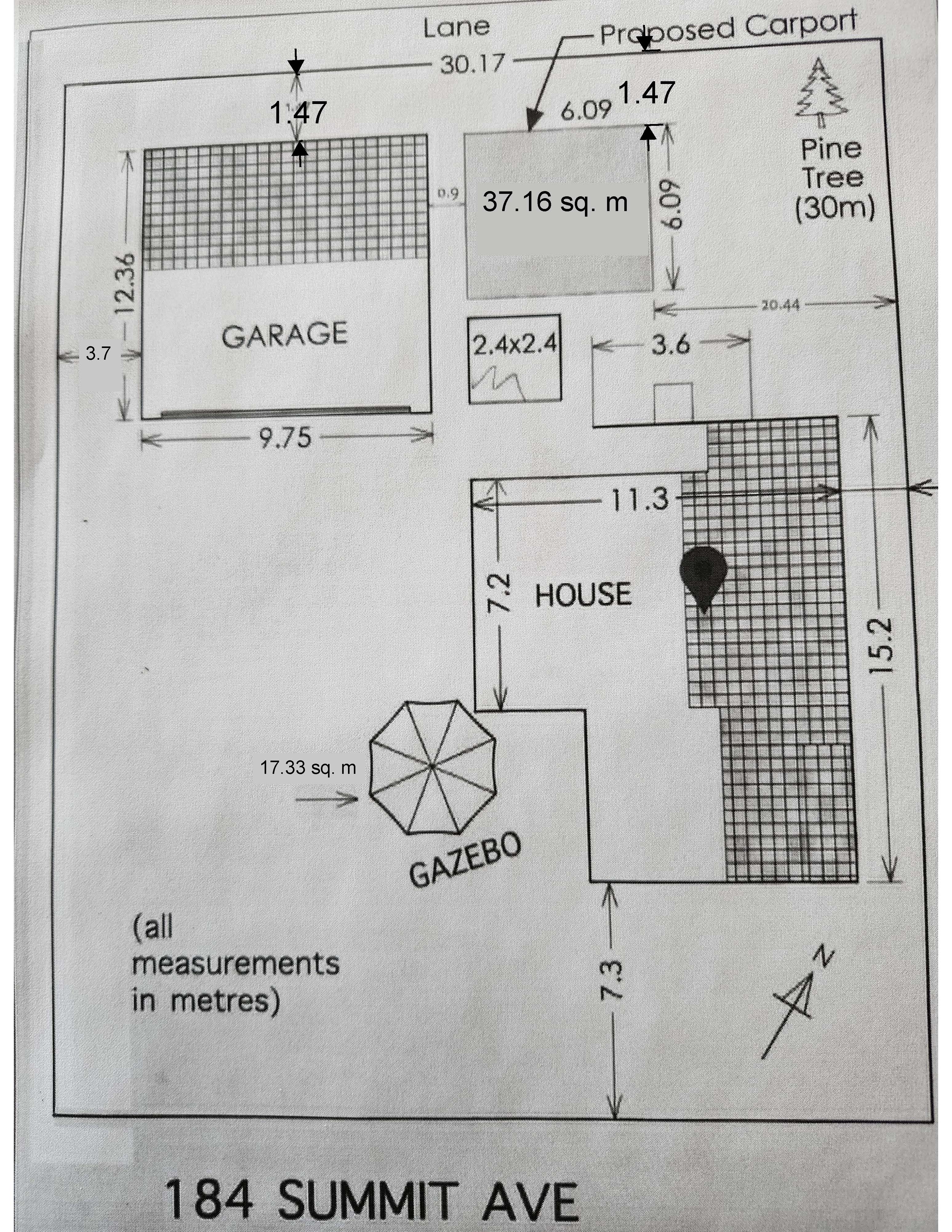
If approved, the effect of this application would be the construction of a new 37 m2 carport. The lands are zoned “UL” – Urban Low-rise Zone and designated as “Residential” in the Official Plan.
The applicant’s site sketch and a key map of the subject lands are shown below.
Key Map of Subject Lands
Applicant's Site Sketch
|
Consent to Sever Applications
| B-35-2026: 65 Banning Street |
|
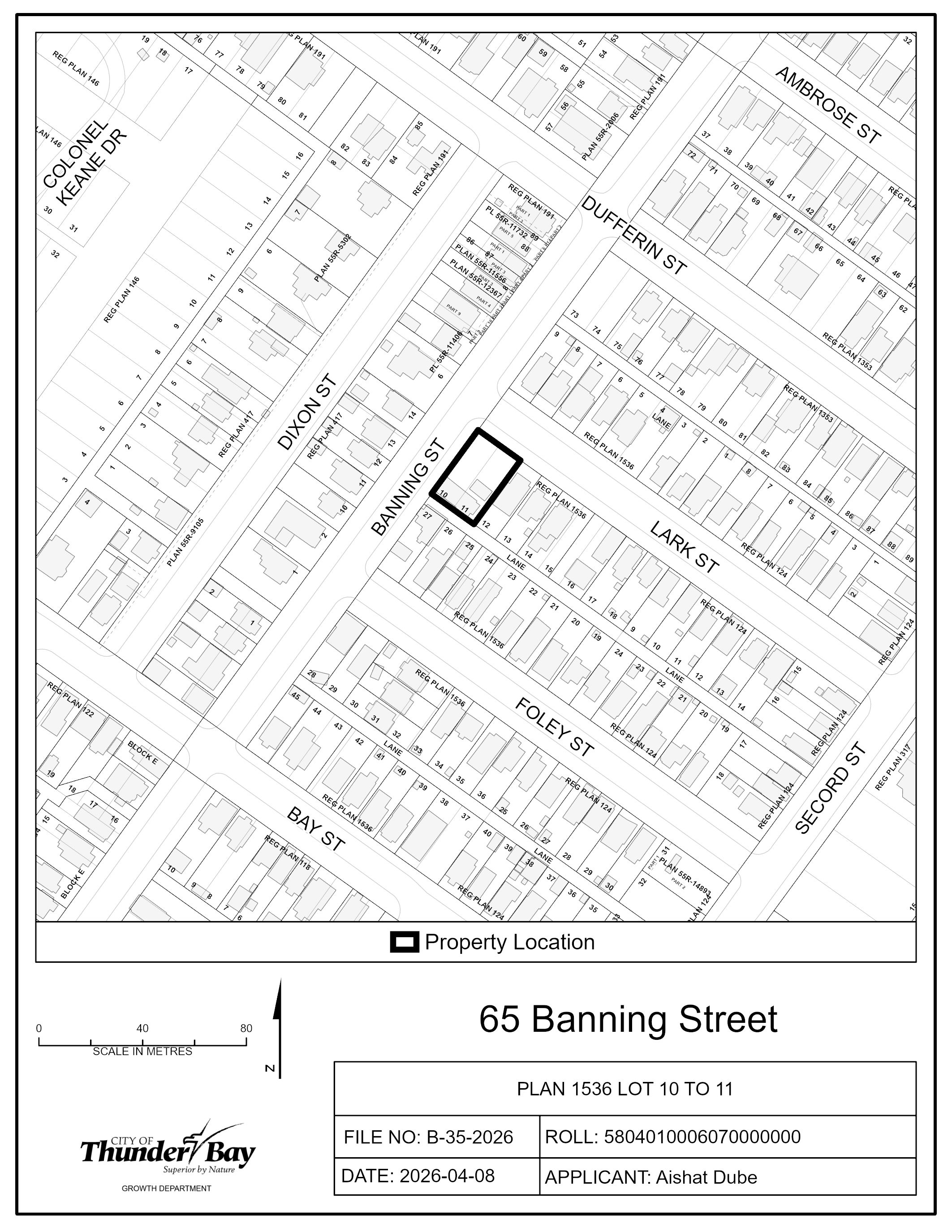
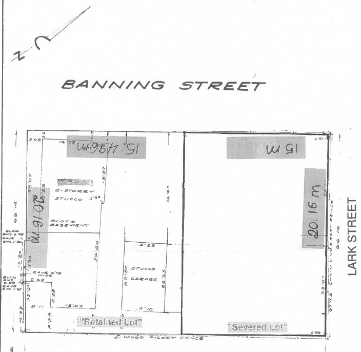
The purpose of this application is to create one new lot. The severed lot will have an approximate lot frontage of 15 m and an area of 302.4 m2. The retained lot will have an approximate lot frontage of 15.49 m and an area of 312.28 m2.
If approved, the effect of this application would be the severance and conveyance of one new parcel of land and to establish any easements as may be required for servicing, as set forth in the application.
The lands are zoned “UL” – Urban Low-rise Zone and designated as “Residential” in the Official Plan.
Key Map of Subject Lands
Applicant's Site Sketch
|
Contact Us
 Subscribe
 Connect