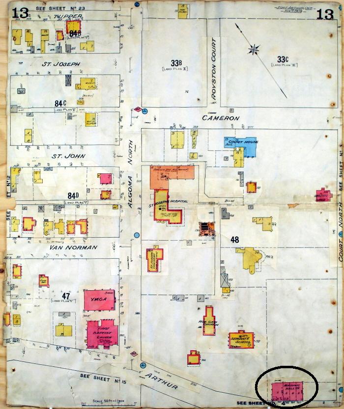
The first Town Hall can be seen in this fire insurance map from 1908, located in the bottom right corner, listed as the Masonic Hall. Fire Insurance Plans were maps of all of the buildings in a location that an insurance company used to assess the risk of fire.

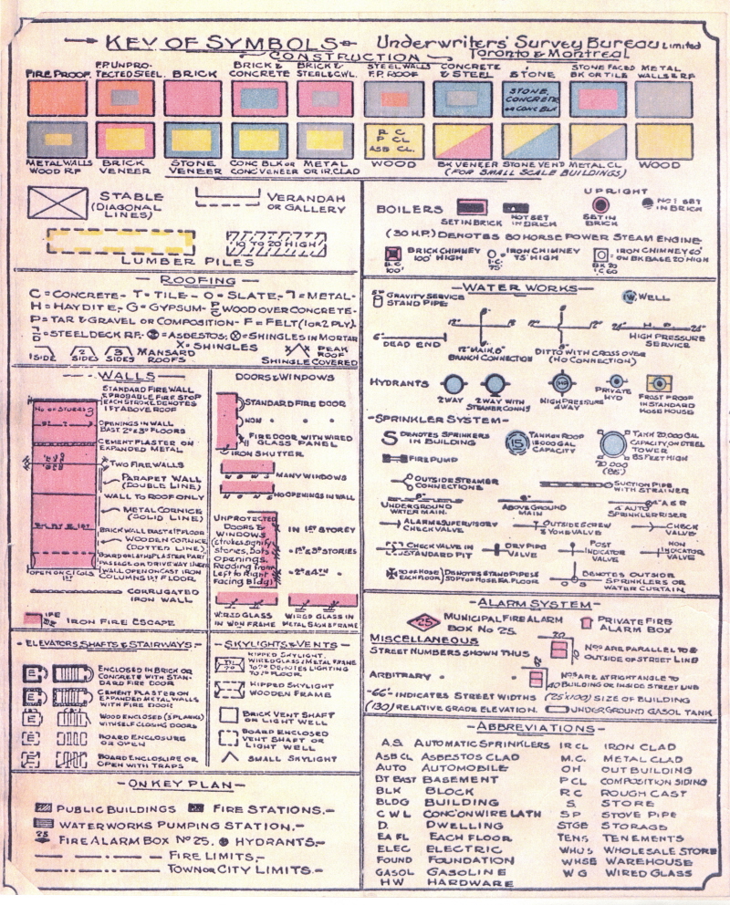
The key for the symbols on the map is provided below.

1908, Fire Insurance Map #13, Port Arthur
Contact Us


