






The 1975 Thunder Bay Waterfront Park Report catalyzed the developments from the last 35+ years and was responsible for highlighting the philosophy that the Waterfront should be an asset for the public of Thunder Bay. Many other reports, with various foci, followed over the years.
 July 1975 - Thunder Bay Waterfront Park July 1975 - Thunder Bay Waterfront Park |
|
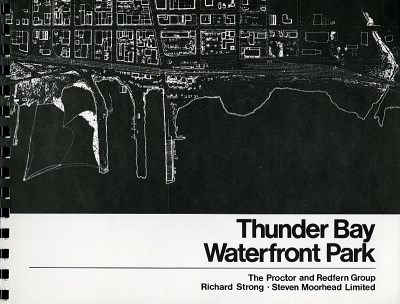
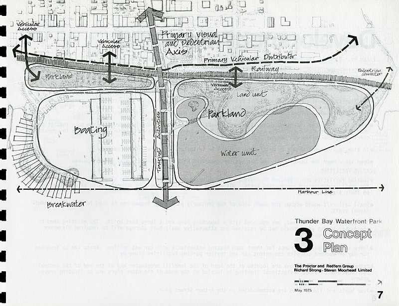
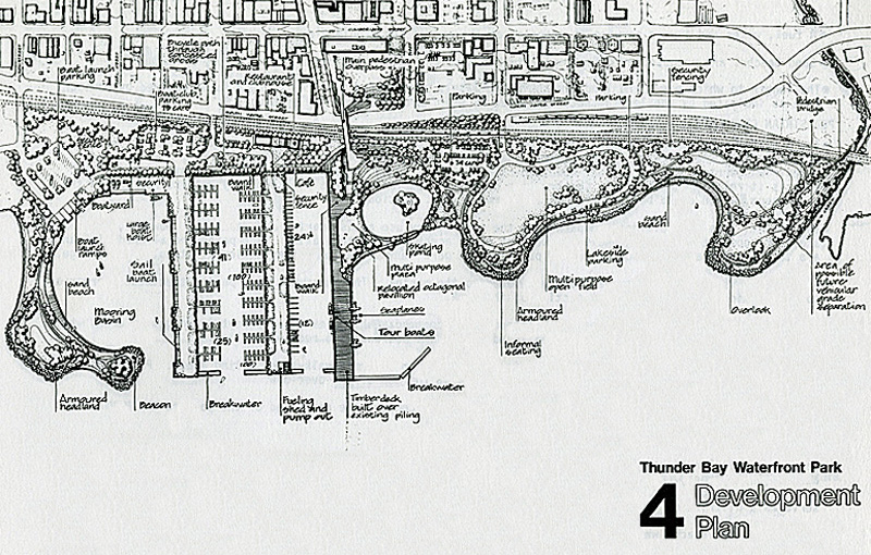
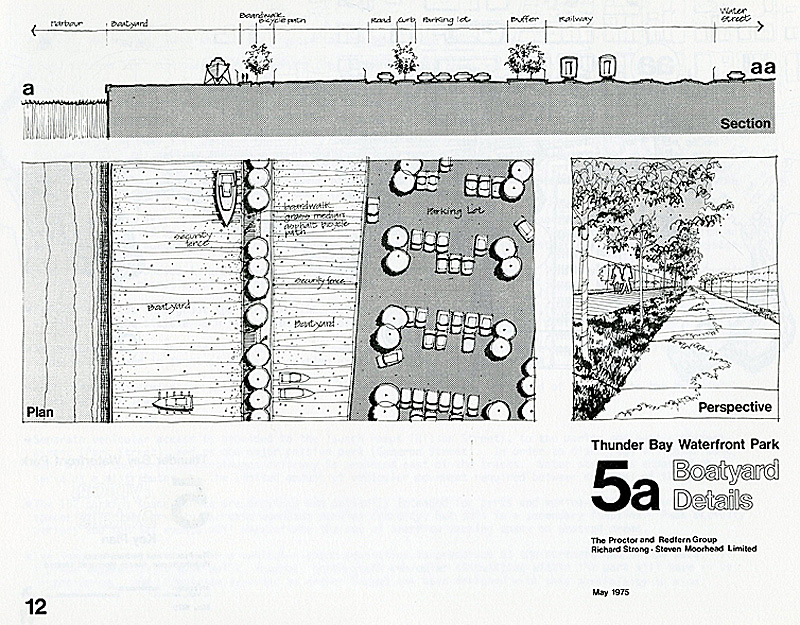
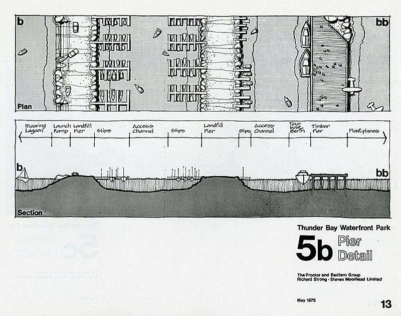
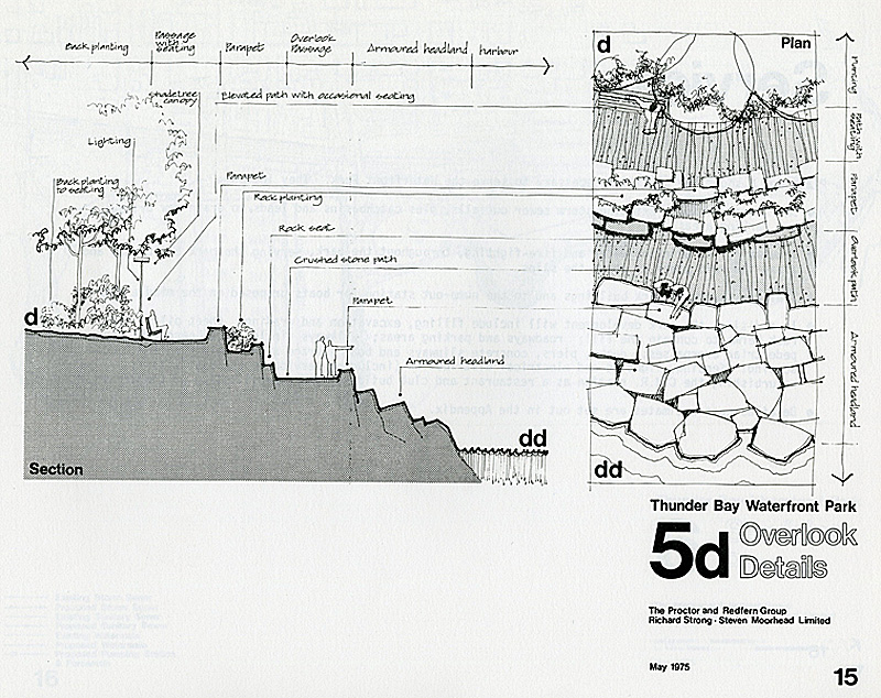
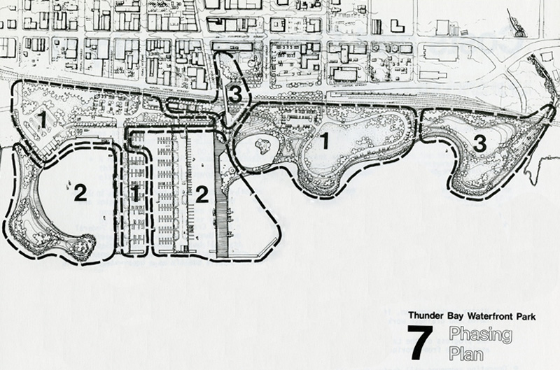
The Thunder Bay Waterfront Park Study plan arose out of the Urban Renewal Scheme of 1967 and Master Parks Plan of 1971. This plan identified the Waterfront as a perfect place for urban renewal. In 1973, City Council agreed that a formal study on development options for the Port Arthur Waterfront was necessary. The Study Team consisted of The Proctor & Redfern Group, Consulting Engineers and Planners, and Steven Moorhead Limited and Richard Strong, Landscape Architects. The Waterfront Park Study Plan was completed in July 1975. The focus of the report is on how to harness the beauty of the lakeshore in the downtown area in the Port Arthur Ward, establish an open space for access to the Bay, and provide facilities for public and private boaters. Once the passive park and boating facility are established, the plan recommends increasing pedestrian and vehicular access to the grounds. The concepts discussed include: open lakeshore, accessibility, varied uses, accommodation of boats, and use of pre-existing facilities. A balance of emphases on beauty, public access, and public and private development would be employed in developments in the North area of the Waterfront over the next thirty years. Involving the community in the development of the lakefront was integral to the project. The Study Team held public meetings in July 1973 and December 1974, and integrated that feedback and the advice of the Coordinating Committee into the final report. The 28-page report includes technical drawings accompanied by descriptive text, including: Context Plan, Existing Conditions, Concept Plan, Development Plan, Boatyard Detail, Pier & Slip Detail, Terrace Detail, Overlook Detail, Servicing Plan, and Phasing Plan. Also, the appendices to the Study set out basic cost estimates as the groundwork for detailed designs and associated contracts proceed. The report was well received and was used as the basis of development for years to come. Waterfront users, citizens and tourists saw the benefits as it kicked off the first major projects to develop the Waterfront as both a recreational area and boating facility.
Archives location: TBA 4735-28
|
 July 1983 - Marina/Waterfront Park Study and Results July 1983 - Marina/Waterfront Park Study and Results |
|
The Marina/Waterfront Park Study was conducted by the Department of Parks and Recreation to gain insight into the needs and opinions of users of the Waterfront facilities, particularly which improvements they would prefer to see made to the facilities. The survey was conducted in July and August of 1983, as part of a larger Study of the Marina and Waterfront. Surveyors asked 28 questions to users of the Welcomeship (a local tour boat), the Marina and Dock, the Public Launch Ramp, and the general park space. A total of 965 people took the survey, including Thunder Bay residents and non-residents of varying sex, age, and marital status, income, and ward of residence. The study, in keeping with the tradition of developing the Waterfront, was dually focused on the Marina as piers, docks, and boat areas and as green areas, playgrounds, and boardwalks. The public's feedback gave the Parks and Recreation Department a comprehensive and detailed view of the features at the Marina that were heavily used, and which needed improvement. Through this study, the City took a proactive stance and brought development issues to the public. Archives Location: TBA 5535-18
|
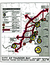 September 1990 - Waterfront Tourism & Recreation Plan - Final Report September 1990 - Waterfront Tourism & Recreation Plan - Final Report |
|
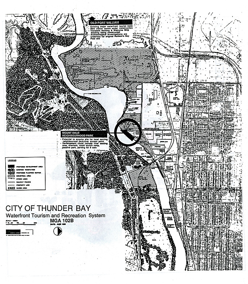
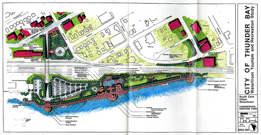
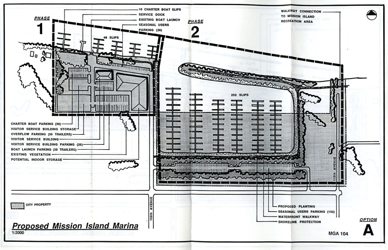
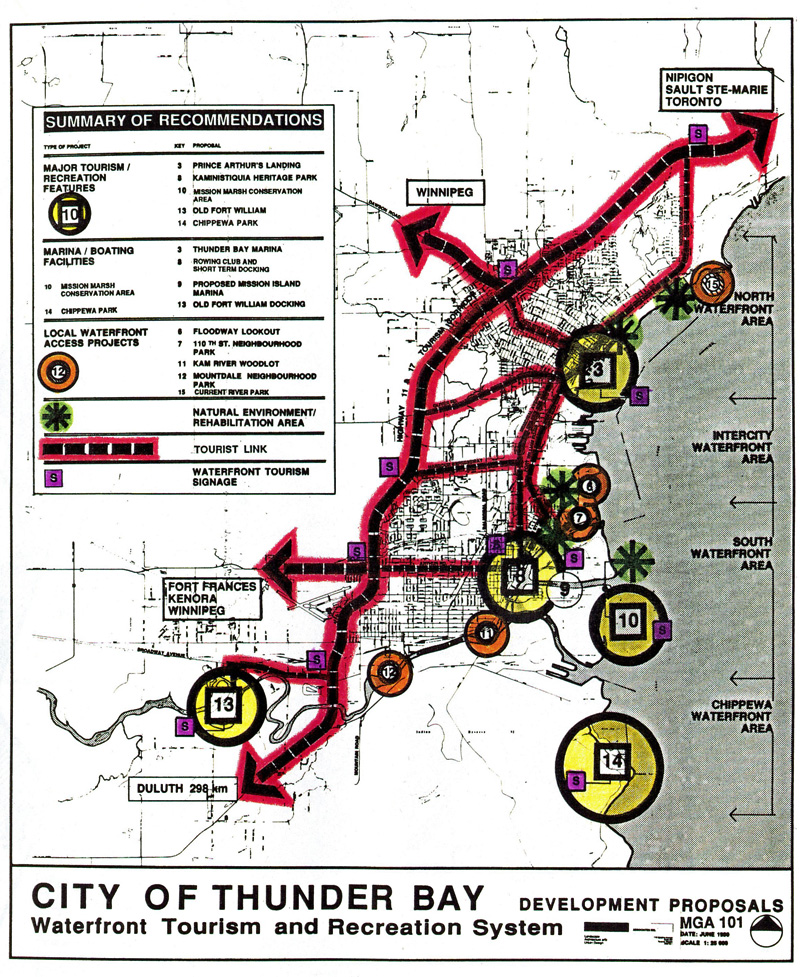
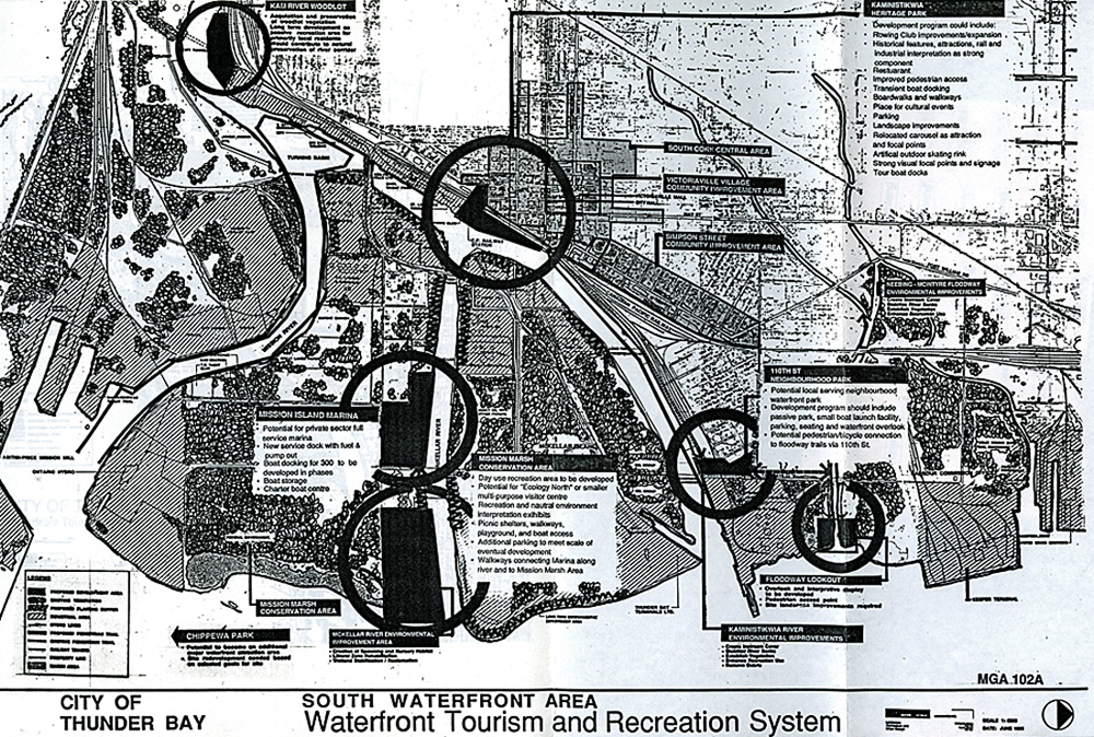
The Waterfront Tourism & Recreation Master Plan and Final Report was released in September 1990. The report was prepared by Moore / George Associates Inc., Landscape Architects and Urban Designers, and Andersen Management Services, under the guidance of a steering committee with representatives from public groups with an interest in the Waterfront. The report served to consolidate existing studies and compile one comprehensive planning document, and is an accumulation of background information, public consultations, prepared development options, and a finalized master plan for development. When enacted, the master plan would enhance tourism, local recreation, and environmental conditions of the southern waterfront along the Kaministiquia River. The highest-priority projects in the South Core were the Donald Street Pedestrian Underpass, Mission Marsh Conservation Area, Kaministiquia River Environmental Rehabilitation, the Mission Island Marina Project, and the Kaministiquia Heritage Park. Land acquisition and development was also highlighted in the report, especially around Current River Park, Floodway Lookout Park, 110th Street Park, Kam River Woodlot, and Mountdale. Two of the greatest successes of the plan were the construction of the 550-metre-long river walk on the Kaministiquia River and the public art competition that spurred the 1992 installation of ‘Animikii – Flies the Thunder.’ The Kaministiquia Heritage Park was to be heavily developed. Since the 1983 Survey of the Marina identified “walking through the park” and “viewing the scenery” as the two most common recreational activities, it was apparent that a scenic promenade would be a significant improvement to the Kaministiquia Heritage Park. The proposal was to create a 550-metre riverfront promenade with three river outlooks/overlooks, and numerous shady areas and benches for sitting. Grassy areas along the promenade were to be landscaped and maintained for passive recreation and viewing. For the central plaza, the City proposed that the Carousel be relocated from Chippewa Park to the Kaministiquia Heritage Park. Additionally, the Park was to be adorned with Thunder Bay heritage themes. As well as enhancing pedestrian traffic through the park, access to the park was another focus: suggestions included better pedestrian and vehicular pathways to the park, and parking lot improvements. The plan was largely focused on implementation, and identified recreational and commercial public and private sector development opportunities. All proposed improvements aimed at drawing in the public and creating an attraction for citizens and tourists alike.
Report location: TBA 5860-47
|
 January 1998 - The Next Wave - Charting a New Course for Thunder Bay's Waterfront January 1998 - The Next Wave - Charting a New Course for Thunder Bay's Waterfront |
|
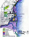
The waterfront development plan "The Next Wave: Charting a New Course for Thunder Bay's Waterfront" was completed in 1998, prepared by The Planning Partnership, Moriyama & Teshima Architects, and Hemson Consulting Limited. The report's four main components were: an overall master plan for the entire waterfront, more detailed plans for key areas of development, a business plan and marketing materials, and an implementation strategy. The plan also included two major privatization proposals, one of which was not implemented - the Science North Complex - and the other of which is currently underway - a full-service hotel. The framework for the master plan is based on three features: new waterfront districts, a new waterfront drive, and a healthy ecosystem. The new waterfront districts are aimed at shifting the urban core to the waterfront in order to provide a waterfront where citizens and tourists can eat, shop, work, live and play. The plan is clear in that it avoids sacrificing the industrial activity of the waterfront but rather includes it as the heritage of the port and the city. A highlight of the proposed waterfront developments is a new Waterfront Drive that would provide public access to the whole of the harbour. Beginning in Current River, the Waterfront Drive would follow the lakefront to Westfort, passing over both the McKellar and Mission Islands. The master plan envisions the new Waterfront Drive as landscaped and green, creating a pleasant parkway road that animates the beauty of the waterfront. The healthy ecosystem is praised and identified as being paramount to the development. The plan provides that the City environmentally enhance watercourses and woodlots, maintain and re-establish marshes, enhance aquatic habitat along shoreline, and continue to encourage industries to reduce their environmental footprints. The co-operation between the City and industry ensures the sustainability of this waterfront vision. Archives location: TBA 7969-29 |
For more information on this subject, or any other subject of interest, please visit or contact the City of Thunder Bay Archives.
Contact Us
 Connect